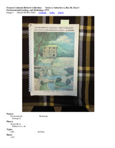
Environmental Geology and Hydrology, 1975
Scope and Contents
The Frances Cabaniss Roberts collection covers the historical records of the Cabaniss Roberts family. This collection contains extensive correspondence records of the Cabaniss Roberts family circa 1830 to 1930.
Dates
- Creation: 1830 - 1930
Creator
- From the Collection: Roberts, Frances Cabaniss, Dr. (Person)
Conditions Governing Access
This collection is open for research in the Archives & Special Collections reading room. Handling guidelines and use restrictions will be communicated and enforced by archives staff members.
Extent
From the Collection: 92.25 Linear feet (176 (18 oversize))
Language of Materials
From the Collection: English
General
Acknowledgments to Organizations & Members 120
Administration & Operations Personnel 122
Agricultural Use of Soil 25
Alabama 29, 31, 38, 39, 95, 122
Asphaltic Limestone 32
Barite 32
Bedrock Geology 19, 20
Big Spring 2, 43
Chemical & Physical Characteristics of Ground Water 71
Chemical & Physical Quality of Surface Water 77, 78
Chemical & Physical Quality of Water 76
Chert 33
Civil Defense Shelters 103
Clay & Shale 32
Clay 33
Climate 12, 36
Coal in Alabama 38
Coal 32
Construction Capability 99, 100
Contents 3
Contour lines & Symbols 7
Contours on Top of Chattanooga Shale 27
Cooperative Research & Studies 122
Credits & Photographs 121
DeWitt, Rita 3
Dolomite 32
Domestic & Stock Water Supply 82
Doyle, F. L. 120
Doyle, Larry 4
Earthquake Epicenters in & Near Alabama 29
Earthquake Risk 28
Electric Power 41
Emergency Water Supply 104
Energy Resources 37
Environmental Geology & Hydrology 1, 2, 3, 5, 121, 123
Environmental Reading 116
Factors Affecting Mining 35
Flint River 49
Flood of March 1973 56, 57, 58, 59, 60
Flood Prone Areas 55
Floods 54
Foreword 4
Frye, William 43
Further Information 115
Future Investigations of the Hydrologic System 86
Geologic Block Diagram 15
Geologic Cross Sections of Wells 26
Geologic Map of Block Diagram 16
Geological Survey of Alabama 4, 122
Geology 13
Glossary 117, 118, 119
Gold 32
Ground Water Availability 67, 68
Ground Water Levels & Movement 62
Ground Water Quality 71
Ground Water 46, 61
Hardness of Ground Water 73
Highland Area water 70
Hunt, John 6
Huntsville & Madison Co., AL 1, 2, 3, 4, 5, 6, 7, 32, 96, 121
Huntsville, AL 2, 43, 56, 57, 58, 59, 60
Hydrolic Cycle 44
Imports For Maufacturing & Construction 35
Impoundments Draft Storage Frequency 52
Impoundments 50, 51
Incineration 107
Industrial Use, Imports, Exports 35
Introduction: Huntsville & Madison County 5
Iron & Sulfates in Wells 73
Jackson Co., AL 51
LaMoreoux, Phillip E. 4
Land For the Future 111
Land Use Categories 97
Land Use 94
Limestone & Sandstone Extraction 101, 102
Limestone along Governors Drive 13
Limestone aquifers 70
Limestone Creek 17
Limestone 33
Liquid Waste Control 109, 110
Madison & Jackson Co., AL 52
Madison Co., AL 2, 8, 9, 10, 11, 12, 13, 14, 15, 16, 17, 18, 19, 20, 21, 22, 23, 24, 25, 26, 27, 28, 33, 34, 35, 36, 40, 41, 42, 43, 44, 45, 46, 47, 48, 49, 50, 51, 53, 54, 55, 61, 62, 63, 64, 65, 66, 67, 68, 69, 70, 71, 72, 73, 74, 75, 76, 77, 78, 79, 80, 81, 82, 83, 84, 85, 86, 87, 88, 89, 90, 91, 92, 93, 95, 97, 98, 99, 100, 101, 102, 103, 104, 105, 106, 107, 108, 109, 110, 111, 112, 113, 114, 115, 116, 117, 118, 119, 120, 123
Madison County Topography 8
Manganese 32
Meridianville Water System 43
Mica 32
Mill 2
Mineral Production 31
Mineral Resources Near Huntsville 32
Mineral Resources 30, 34
Mineral-Related Exports 35
Municipal Land Use 103
Natural Gas Supply 40
North Alabama 32
Oil & Gas Board of Alabama 122
Oil & Gas Exploratory Wells 40
Overview of Natural Resources 114
Paint Rock River 51
Permits 116
Petroleum & Natural Gas 39
Phosphate 32
Physical Factors Affecting Future Land Use 112
Population Density & Growth 94, 96
Population Pattern 95
Precipitation in the Huntsville Area 65
Present Land Use 98
Projected Water Needs 85
Public Supply Water Use 81
Public Water Supply Systems 83
Public Water Systems 84
Publications 116
Recharge Areas for Public Supply Wells & Springs 63
Recreation & Transportation 87
Recreational Areas 89
Recreation 88
Red Iron Ore (Hematite) 32
References 113
Regolith water 70
Regolith 22, 23
Roberts, Frances 4
Rocks Exposed in Madison County 14
Rocks Known From Well Records 25
Round Top Mountain 17
Rural water Supply 82
Sand & Gravel 32, 33
Sanitary Landfill Data Collection Network 79
Sanitary Landfill Data Collection Sites 80
Sanitary Landfill Suitability Map 108
Sanitary Landfill Water Quality Monitoring 79
Sanitary Landfill 106, 107
Selected Wells & Springs 65, 66
Shale 33
Slope described 10
Slope map 11
Soil Associations 24
Soils 23
Solid Waste Control 105
Sources of Energy 42
Special Land Use Categories 97
Storm Shelters 103
Streamflows 48
Suitable Areas for Recreation & Conservation 90
Sulfates, Nitrate & Chloride in Wells 74
Surface Drainage & Urban Development 53, 54
Surface Geology 17, 18
Surface Water Development 49
Surface Water Quality 74
Surface Water 47
Tennessee River Basin 45
Tennessee River 43, 49
Thickness of Bedrock 21
topographic map symbols 7
topographic maps 6
Topography in Colored Relief 9
Transportation - Airlines 92
Transportation - Highways 92
Transportation - Navagable Waterways 91
Transportation - Railroads 93
Transportation Facilities 35
Tripoli 32
TVA 41
United States 30, 37, 94, 122
Urbanization Effect on Floods 56
Urbanization 36
Waste Material Control 105
Water Data Collection Sites 72
Water From Streams 48
Water Level Changes 65
Water Level Fluctuations 64
Water Quality Data Sites 75
Water Resources 43
Water Sources 82, 84
Water Temperature 72
Well Drilling & Development Problems 69
Williams Well 65
Repository Details
Part of the The University of Alabama in Huntsville Archives & Special Collections Repository
M. Louis Salmon Library
301 Sparkman Drive
Huntsville Alabama 35899 United States of America
256-824-6523
archives@uah.edu

